RECENT WALK AND SPRING NEWS UPDATE

Reaching Milton on the East Coast a month after setting off from Christchurch via Arthur’s Pass and the West Coast of the South Island, NZ.
‘FIGHTING CANCER ON FOOT WITH THE CROWN WORLD WIDE WANDERERS’
Robin’s latest 1200 km walk finished successfully with the final laps around Forsyth Barr Stadium completing the campaign for Relay for Life. Since 26th January, Robin has been promoting Relay for Life in New Zealand by walking across the Southern Alps and West Coast of the South Island. He has also been raising funds for Cancer Research UK and has planned another walk for the charity in April (see justgiving page below). On the 9th March Mr Moore joined the Crown World Wide Wanderers for Relay for Life in Dunedin where we successfully raised over $2000 for the Cancer Society of New Zealand. We are anticipating the combined effort of the 108 teams involved at the Forsyth Stadium will have collected over $230,000 in Dunedin for the charity.
ROBIN MOORE’S NEW ZEALAND CHARITY EXPEDITION
This story follows Robin Moore’s charity expedition of the South Island’s scenic West Coast and the Southern Alps. The journey first crosses Arthur’s Pass on the coast-to-coast between Christchurch and Greymouth; then follows the coast road to Haast before encountering rain forests, gorges and lakes which make up the unique terrain around Wanaka and Queenstown. Heading back to the South Coast via New Zealand’s gold-mining towns, the walk draws to a close along old railway tracks, river trails and Highway 6 set against a green hilly backdrop, finally concluding at the city of Dunedin.
THE WALK
PHASE 1 – CHRISTCHURCH TO GREYMOUTH (Via Arthur’s Pass)
Commencing 26th January
DAY 1 CHRISTCHURCH TO WEST MELTON -26KM
Feeling jetlagged and somewhat overloaded with equipment, I departed from the Cancer Society and steadily made my way out of the city in the direction of the West Coast highway – Route 73. Stopping at Tower Junction I purchased a charger for my phone and had a sausage sandwich at the Lion’s stall where one of the attendants sponsored me $5 and wished me well for the journey. The hot conditions today were unforgiving as was the weight in my pack which I felt was a few pounds over a comfortable load. It is often hard to know what to take on these types of expeditions and in any case I usually have to carry my entire luggage for the whole trip.
Soon I was beyond the city boundaries and after Hornby my relationship with the road became a quiet, diminutive affair as I made my way to West Melton. The township comprised of a few houses, garage and tavern with ground space where the landlady let me camp for the night. It was a social Saturday evening with a few locals watching the races and small groups enjoying their chat; I was simply glad to quench my thirst and have a home-cooked meal and by nightfall I retired to my tent for the first night of many under canvas.
DAY 2 WEST MELTON TO DARFIELD – 25KM
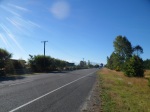
I rose to dull and misty weather though it soon became hot as I slowly made my way along the desolate main road. At a forest junction I stopped to talk to a lady who was on her daily morning walk; she was interested in my travels and we chatted for 10 minutes or more. Continuing in the heat I made it to the next village around noon and stopped for a drink of water at a garage. From here I walked a tough 8km to Darfield where I pitched my tent at the Domain Recreation Ground; later I visited the tavern and enjoyed a roast dinner. After refreshment I went to the shop for some snack food and feeling tired I retired to the shade of the park where I appreciated well earned rest.
DAY 3 DARFIELD TO SPRINGFIELD – 23KM

I woke before sunrise hoping to keep a step ahead of the heat and the first 12km to Waddington went reasonably well. Stopping at the green across from the Sheffield Pie Shop, I watched the Trans Scenic train run past on its way across Arthur’s Pass to Greymouth – my destination at the end of the week if I am lucky enough to survive the heat. Unfortunately there was not any wind in sight and I suffered quite badly with heat exhaustion by the time I reached Springfield. I spoke to a guy at a campsite who gave me some water and on reaching the hotel in town the landlord and his staff were kind enough to let me pitch a tent in the yard where they were developing a backpackers unit. Here one can grasp the impact of the first earthquake that hit Christchurch causing most of the damage to suburban areas and countryside. 10.5km below Darfield the earthquake began – speeding towards Christchurch damaging all that lied in its path. The staff explained the cost of the disaster to them personally and the political issues surrounding the regeneration programme; later they invited me to a barbecue and offered advice on how to cope with Arthur’s Pass in this heat which has now brought about an official drought in the area. With extra food on board I decided to rise at 4am and take a siesta during the middle of the day; the whole pass would have to be split over 3 days which would mean a night or two under the stars.
DAY 4 SPRINGFIELD TO LAKE PEARSON – 40KM
And so it begins! Leaving in the dark I gave myself a good head start against the formidable heat which would exceed temperatures of 35 degrees. The first testing encounter was a steep section over Porters Pass where the winding road was unrelenting in its ascent. As the journey developed so to did the scenery which was sublime if not surreal and yet welcoming only the call of the wild. Eventually the pass drops to Lakes Lyndon on the left with Coleridge in the distance. Although the journey offered some respite the mountains remained dominant and later there was an interesting rock formation on the rise above Castle Hill. Stopping at the holiday village of Castle Hill a couple invited me into their cabin for a meal and a cold drink. They were heading back to Wellington and hinted that they could be at the test match when England tour in March. After an hour of good chat we parted company and I was left again to battle with the heat over Craigeburn with a view to camping at Lake Pearson later tonight. Around teatime I stopped at a small lodge where a pretty young maid served me food and ale. She had come here from Christchurch after the earthquake and I could sense sadness about her as she went on to admit she was unhappy with her life at present. Like many of her age group it is a case of making do until something else comes along and then being able to grab the initiative. After the interval I enjoyed a quiet cooler session, aided by breeze, as I walked down to Lake Pearson where I camped in the company of water fowl.
DAY 5 LAKE PEARSON TO BEALEY LODGE – 34KM
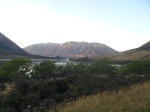
After a breakfast of sardines which I shared with a local water hen I set off in the dark, misty haze which obscured all else but the road. These few hours ensured I made good speed whilst observing the sound of occasional traffic. As the sun rose above the mountains the heat kicked in along the steep unforgiving climbs. Reaching each summit along Arthur’s Pass just ‘blows you a way’ up here and at least the overwhelming scenery becomes an opiate in these exacting times – its difficult to know which will wear out first – my body or my camera! Today I was in good nick and made it to Bealey’s Lodge by lunch time. Here the staff made me most welcome and let me have a cabin for the night. Later I chatted to a family group who gave me a meal and Vicki who works at the inn offered to take some of my equipment back to Christchurch as at present I was carrying too much in this heat. Constant backache and groin strains often meant I couldn’t walk properly nor gather the momentum required to cover a respectable distance. My stop at Bealey’s Lodge turned out to be a lovely experience and I enjoyed a proper rest which would make the difference in tomorrow’s effort.
DAY 6 BEALEY’S LODGE TO JACKSONS – 50KM
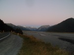
Setting off around 6.30am, I made it to Arthur’s before nine and stopped at a cafe for a pie and coffee. Soon the coast-to-coast triathlons will be passing through from Hokitika on a major event which also includes running, cycling and about 60km of kayaking through the pass. Leaving here the scenery around Otira gorge was something to behold and I was in awe of its presence; bottomless terrain beneath timeless bridges and the constant flow of water cascading from the mountains. Stopping at lunchtime at the Otira inn I enjoyed a sandwich and chat to the landlady and another couple who were travelling around the country on holiday. Apart from the inn there was little else here; though in the age of the railway many of the workmen stayed in Otira as men from all corners of the country flocked to the region to obtain a hard- earned dollar. In those difficult times they would have earned every cent in a dangerous environment where each day was about survival.
From here I stepped up the pace walking the whole session of 20km to Jackson where the cheerful owner of the campsite let me stay for free; I then headed back to the region’s most famous pub where the ladies ensured I was watered and well-fed. I sat for a while enjoying my jug of ale and admiring the wonderful interior of this iconic place which has played an important role in quenching thirst for a century or more.
DAY 7 JACKSONS TO MOANA – 28KM
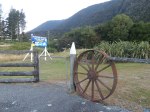
After a lovely breakfast with a group of Canadian tourists who were very kind in offering me some food, I set off taking the low road. The late start ensured it was a laboured affair and as the day moved on I developed blisters and had trouble walking properly. I stopped first at a fishing lake for a sardine lunch and made a few excursions throughout the afternoon to refill my water bottles. Before setting off on the last 6 km of the day I spent time at a farm where Mr and Mrs Usher invited me into their home for tea and biscuits. I was relieved it was a short session and I made it to Moana, set beside the picturesque Lake Brunner, around 7pm. The lake-side views soon washed away the torment of the day and when I enquired at the pub about camping the night the landlady let me stay in a cabin for free which was a wonderful reward for my day’s toil. I also had a good meal and ale; later I spoke to a young lad called Shaun from Manchester who was on a fishing holiday along the West Coast.
DAY 8 MOANA TO STILLWATER – 24KM

Setting off in what was the closest I’d seen to drizzle so far, I enjoyed the cooler start making short work of the journey to Stillwater; descending into town I passed the cemetery and memorial for the Brunner Mining disaster. Turning right at the bottom of the hill I made my way to the hotel where the landlady was also kind enough to let me use a cabin for the night. It was a busy place and later a stag party arrived to liven things up a bit – they were all just lovely people celebrating the life and times of yesteryear; I also chatted to another Kiwi who was on holiday with his son and some friends from Scotland. By 10pm I retired to my room to watch TV/Rambo as the fading sound of cheerful banter drifted me into slumber.
DAY9 STILLWATER TO GREYMOUTH – 15KM
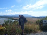
Rising to the peace and solitude of Sunday, I now embarked on the last section of the coast-to-coast which will see the completion of phase 1. The first hour was a cultural experience visiting the old Brunner Mine Works originated in the 1870’s and developed throughout 19th century. It reopened in the 1920’s and the memorial at Stillwater stands in honour of those who died in that period. Across the water lies Taylorville and the next stop ahead was a motor café at Dobson where I was joined by fisherman Shaun who I met at Moana and who was also walking to Greymouth. Together we walked into town, finishing the day at Greymouth Tourist Centre at the train station where Shaun had enough time to book his trip back to the North Island where he would spend the rest of his holiday with his aunt from Tauranga.
I soon found the campsite at the Domain and promptly entered the pub across the road to celebrate my walk with the locals. Tomorrow will be a new chapter in my journey as I head of down the West Coast to Haast and the pass beyond.
PHASE 2
GREYMOUTH TO HAAST (Via Highway 6)
Commencing from 4th February

DAY 10 GREYMOUTH TO PAROA – 15KM (Total walked)
After decamping quickly during heavy rainfall I made my way to the Cancer Society for a press interview with the Greymouth Star. Then having updated my blog, I walked on to Paroa where the hoteliers let me camp on their land by the railway. The bar maid, Olivia was kind to me and took me back to her place for a shower, clothes wash and later a meal at the inn. It turned out they were all good friends of ex-pat Richard Blakeborough who I knew from Oundle, making our liaison all the more interesting. Tonight the patrons consisted of a group of workers and also a few holiday makers staying at the motel. I stayed only until dusk when I was happy to return to my tent to sleep.
DAY 11 PAROA TO HOKITIKA – 30KM
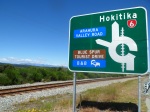
The 6am freight train to Hokitika was my alarm call today as it thundered through shaking the ground I lay on; I was soon up and packed to make the most of a cooler start on a day which I hoped would yield around 30km. The cool air allowed me to wear more layers rather than carry them for a change and apart from a few litter collectors along the highway I saw only cattle and deer grazing the rich pastures. Later I came across a bridge which was under repair; oddly it also shared its access with the railway. It looked a bit dodgy to say the least and as a car entered I immediately followed behind sprinting all the way to the end – quite scary!
The cafe was closed at Kumara Junction so I continued a few km past the triathlon coast-to-coast start point and stopped for breakfast next to a crash barrier. There was little of interest along the way though it was nice to see the sea and occasionally I’d stop to enjoy some shade beneath a bridge or at a bench in a picnic bay.
8km from Hokitika a lady stopped by to give me some spring water and once in town the landlord of the Pioneer Hotel was kind enough to let me camp in his spacious beer garden. They were a bloody good crowd in the bar and I stayed with them until closing time sharing a beer with Wayne Stuart who was heading back to Australia to work, but also took time out to offer advice on where to stay at Bruce Bay when I arrive there next week.
DAY 12 HOKITIKA TO ROSS – 30KM

The freight train was again my alarm call- just a little later this time but I soon dismantled the tent and pressed on across the bridge now bound for the Gold Town of Ross. I made good ground to Lake Mahinapua where I stopped for a breakfast of sardines and honey. As the journey evolved I enjoyed the scenery largely dominated by forest and the ever-present Southern Alps and to the right was farmland broken by streams and rivers. Stock ranged from deer, cattle, goats and sheep which all seemed alarmed to see me pass by. There was little to get excited about at Ruatapu though I still needed to rest so as to protect my feet from blisters as the day approached its hottest temperatures. By 2pm I had reached the old gold town of Ross where I was offered a camping spot at the old Empire inn – a splendid characterful place in a prime location by a small lake. My only neighbour was Raymond the pub goat, though later another traveller pitched up and camped nearby; he was also heading to Dunedin for the cricket and kindly donated $20 to the Cancer Society.
DAY 13 ROSS TO HARI HARI – 50KM

It was a lovely start at 5.30 am as I bade farewell to Raymond who was also up and ready for another day of maintaining the pub lawn. Beyond the town the beautiful forest offered protection from the heat as the sun rose over the mountains. I was waved on by road workers and often drivers tooted their horns. Mid-morning I refilled my water bottles at a farm and later stopped at the Bushman’s Centre where I chatted to the owners – the lady in fact hailed from Lancashire. The lady had an interest in my knee straps which I use to protect my joints from the heavy pack –perhaps her husband could try these to combat his arthritis? Leaving the premises I noted the giant sculptured body of a sand fly which did not bode well for the journey ahead. Walking through Kakapotahi Forest I took pleasure in mimicking the birds which seemed happy to oblige with some rhythmic sounds. The cattle were also vocal but less endearing as they charged along their paddock adjacent to the road. By lunchtime I had reached Lake Ianthe which was a popular location for the campervan fraternity – I also dwelled a while to enjoy a sardine and peanut butter lunch.
The rest of the day dragged on a bit as I trudged over more narrow bridges some had flowing water beneath; others barely a trickle as drought loomed ever close to the West.
Happily I arrived at Hari Hari where the landlady of the Hotel, Penny McCaul made me most welcome inviting to camp and use the facilities; after an update to my diary I went to the bar to order a meal and a jug of Speight’s beer.
DAY 14 HARIHARITO WHATAROA – 30KM

Starting in the mist around 6.30am I enjoyed the forest views and winding roads which were more like a cycle route than a main road. With all the wonderful scenery and panoramic views the region has become a Mecca for photographers and artists. There was barely a place in sight and later I ate my breakfast in a lay by atop the hill overlooking the gorge.
I passed numerous cattle fields and soon the mighty glaciers began to dominate my vision. On reaching Whataroa I stopped at the shop to ask for some sardines; the lady frowned at me and looked at her colleague retorting not too many of them around these parts. In a despairing effort to resolve my plight I ordered fish and chips and a flat white coffee. I fared better at the inn where the landlady who had only been there a month let me stay in a room. I enjoyed a meal in a lovely pub atmosphere where I felt the warmth of humanity. A pleasant night’s sleep and dry kit for the morning made it all the more a special place.
DAY 15 WHATAROA TO FRANZ JOSEPH – 32 KM

Setting off at 7.15am I powered into the cool air making excellent progress as far as Lake Mapourika where the Lions club where hosting the South Westland Fishing Competition – a 24 hour salmon fishing contest. They were very friendly and invited me for breakfast where we also took photos to mark the occasion; later some young ladies showed me part of the lake which they use for leisure. After returning to the road I met a cyclist who had passed me a few times and knowing about my expedition offered to sort out a place to stay at Makarora later next week. A little further on I was able to look back across the water where I had stood earlier; by now there were plenty of boats afloat around the lake.
Soon I was entering the iconic region known as Franz Joseph where helicopters hovered above the queuing tourists all waiting eagerly for a glimpse of the famous Glacier. My interest lied with shelter and cricket and I was fortunate enough to obtain a camp pitch at the nearby backpackers. Later I cooked a meal with some other travellers from the UK and at the bar watched England beat NZ at 20-20 cricket.
DAY 16 FRANZ JOSEPH TO FOX GLACIER – 24 KM
This was a tough little hike amid steep winding roads which as the heat emerged proved to be quite an ordeal. Throughout the morning I leaned into the mountains, crossing the road to avoid the traffic on the bends and looking for a water supply at the top of each hill. By lunch time I was glad to reach the quaint little refuge of Fox Glacier where the publican let me pitch my tent at his camp site a km or so west of the town. Most of the occupants here were preparing for a climb to Fox Glacier; other holidaymakers were enjoying some culinary treats prepared at the site kitchen. Returning to the inn I enjoyed good ale and food whilst chatting to the cheerful bar staff – one young lady hailed from the UK. I also spoke to another couple camped next to me who told of the journey from Haast to here. They merely re-iterated what I already predicted – there would be minimal facilities on offer for the next few days which were calculated to be the longest of the tour.
DAY 17 FOX GLACIER TO BRUCE BAY – 50KM

It was cool enough when I started at 7am but it rose to a hot temperature by breakfast time. Stopping at a farm for a bite to eat I chatted with there farmer who in fact owned the pub I frequented the night before. Shortly after resuming I met a guy called Nigel from Padstow who was cycling around the world; it was great to see another traveller and exchange stories – hopefully I’ll be in touch again when I’m next in Cornwall. As the day rolled on so did the weather turning wet by afternoon. This was a unique session by the forest where I could hear the roar of the Tasman beyond the trees. Soon the coastline revealed its might adding to the bleakness of a wet day though by the time I reached Bruce Bay the rain had subsided. Following Wayne’s advice from Hokitika, I called at the lodge opposite the village hall, where proprietor John Birchfield was kind enough to let me stay at his cottage where I enjoyed a meal, beer and a good night’s sleep – what a star!
DAY 18 BRUCE BAY TO KNIGHT’S POINT (3KM BEYOND) – 54KM
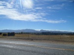
After thanking John for his kindness I headed off up the road with a spring in my step. First I had to cross a narrow bridge and on the first attempt had to retreat to let a coach go through. Later I met a pair of idiots on the way to work; they pulled up giving me the smart talk about how I should be walking across the forests and not on the road I was about to ask the mouthy driver when he last walked the coast when a fellow worker pulled up and I left them to hopefully have a saner conversation than the 90 seconds of dribble I’d just listened to. Any way these sorts have rarely done anything worthwhile with their own lives so tend to go out their way to put others down – he needs to know why I’m here – after all ‘what comes around goes around’ and he could easily one day find himself the at the wrong end of the deal.
Stopping at the Salmon Cafe I was treated to cake and coffee while manager, Graham, offered to fix my rucksack which had broken under the sheer weight I was carrying. He arranged to track me en route and return it to me once the repair was strong enough. I agreed heading off at amazing speed feeling liberated from the burden I had carried for there last fortnight plus. By the time he caught up with me I had reached Lake Moeraki and was engaging in conversation with some fishermen/women from Wanaka which I hope to reach by the weekend.
After thanking Graham who gave me a salmon sandwich for my supper, I continued uphill to a lodge where the owner seemed a little preoccupied with his conservation duties. He said something about camping at a power station which I never found it despite turning off on a few lanes. Passing over another bridge I was soon hitting the high ground around Knight’s Point. I could not camp here but later met another conservationist analyzing a land slide beyond the point, who gave me advise and also took a few photos of me. By nightfall I had camped in a side lane on descent from the high ground where the rain kept me awake for most of the night.
DAY 19 KNIGHT’S POINT TO HAAST – 21 KM
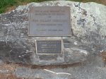
I did not realize the progress I had made yesterday and by noon I had reached the river ferry site where I spoke to the two ladies who help run the enterprise. Next I was braving the high winds of Haast Bridge as I entered the junction; here the pub owner let me camp on the hotel grounds by the staff section so I could use the facilities. It was a busy little enterprise and soon the bar began to fill with residents settling in for a meal. The food was good and I was able to watch the cricket for most of the evening though my thoughts were never far away from the road as I now began to focus my mind on the long placeless trek through Haast Pass to Lake Wanaka.
PHASE 3 -12 /02 (Haast to Queenstown)

DAY 20 HAAST TO PLEASANT FLAT – 47KM
A cool start gave me great momentum as I began my walk across Haast Pass which was a combination of forest and mountains poking through the misty haze. Before the 1960’s it was pretty much the ‘Wild West’ as there wasn’t even a road here! When one was eventually put in it was literally just a single gravel track linking the west coast to Otago; in those days the only visitors were deer stalkers and fishermen until the 1980’s when the road became sealed allowing modern day traffic passage to the other side. It was a tough world back then and I can tell you it isn’t too easy now on foot with no real towns of substance until reaching Wanaka in roughly 4 days time! On the way through I met a European hiker heading towards Haast; he was tramping around the country for leisure with a view to camping at the township ahead. I also met a European cyclist who was heading up to Greymouth; although yesterday’s head wind had hampered his progress he was heartened by the news that he only had a short distance to his next stopover. I made decent progress covering 47km when I reached the campsite at Pleasant Flat – though I renamed the location ‘Unpleasant Flat’ owing to the population of sand flies here. My neighbour, Todd from the USA, was travelling by car and would be heading back to Christchurch tomorrow to see his girl friend. Whilst conversing he did at least give a valuable insight into how I could walk from Mexico to Canada – one for the future maybe?
DAY 21 PLEASANT FLAT TO MAKARORA – 37KM
The warmer air today coupled with the sand flies presented a greater challenge across the mountainous terrain. There were tall bridges to cross and steep narrow winding sections to encounter throughout the day; frequently I crossed the road so as to remain visible to the oncoming traffic which largely comprised of camper vans and coaches. The scenery was awe-inspiring accentuated by the powerful cascades tumbling from the mountains and fast-flowing rivers expanding across the pass. I met a couple of cyclists at a woodland park who had biked down from Cameron where their camper van was parked. They also spent the night with the sand flies at Pleasant Flat and had seen me arrive the previous evening. They had lost a good friend through a cancer related illness and have been supporting the charity for several years since. Later I stopped at the Cameron Camp Site for a peanut butter sandwich whilst enjoying the views of the road I had just walked. For the remainder of the journey I followed the trail of dead opossums, and although I had seen numerous signs for feral poison control, evidence suggested that the road’s cleansing powers were efficient enough. It was 3.30pm when I reached the campsite at Makarora where I was welcomed by the receptionist who let me camp for free and later I ate and drank in the bar. I can tell you I had the biggest roast beef dinner imaginable – I didn’t know whether to eat it or climb it! In a region renown for its mountain ranges and challenging pursuits ‘Everest Meals’ could easily catch on here as a marketing slogan; though I managed to eat the lot, drink a jug of ale and watch England win the 20-20 series – all good stuff!
DAY 22 MAKORORA TO LAKE HAWEA – 49KM
It was always going to be a ‘tough day at the office’ with nearly 50km to walk in testing heat – especially when accompanied by those blasted flies! At least I was ready for it, stopping to enjoy a coffee at the Makorora Township cafe before powering into the morning stretch which exposed me to panoramic views of Lake Wanaka to my right. Stopping very briefly at a picnic area close to the lake, I waged a brutal war with the sand flies who were trying to steal my sardines; then in despair I marched off towards Lake Hawea. There was a break from the water initially and as the road descended eastwards views of Lake Hawea came into focus. A Swiss group took photos of me above the lake and after I followed the winding course for several hours. I spoke to a guy and his son fishing nearby and stopped at a picnic area to bathe my feet in the lake. The water was crystal clear and as I sat mesmerized by its tranquility a small group in a boat drifted into the shore. They were barely on shore 5 minutes and the vessel was hooked up and away up the lane for home. That was my cue to get going too having dwelled for almost half an hour. The pleasantries of the lake helped to energise me and I picked up a good step as far as a small farming community. I stopped to chat with the local farmer who drained off some water for me from a nearby stream and to my delight told me I was only 4 km from Lake Hawea Campsite. As the cool evening air blew across the water I came across Mike and Lorraine’s Campsite at the foot of Lake Hawea which was a welcome relief after some tough miles. I was tired, thirsty and had severely cracked feet; hardly a surprise after treading 1000km of tarmac in the last month! Luckily my hosts were very kind and ensured I was watered and fed; I shared a pizza meal with them and their friends, Roger and Glenda Baldwin from Picton. Later we had tea and a pasta supper before I retired to a much-needed sleep. My day was complete thanks to a little help from some big-hearted people. Bless them – they were brilliant!
DAY 22 HAWEA TO WANAKA – 15KM

Today was short in comparison to those of last week; it was 15km to Wanaka and that left only Queenstown ahead as my last major staging post in the journey. On reaching the popular holiday town which is situated on the Southern end of Lake Wanaka I found a lovely camp site called Wanaka Lakeview where the lovely manageress, Kelly Cambell let me pitch for the night. The town is the gateway to Mount Aspiring National Park comprised of remote wilderness, awe-inspiring mountains and beautiful river valleys. The park forms part of the Te Wahipounamu World Heritage Site and is often referred to as a walkers’ paradise! Although I felt a touch rundown I still took a walk around the town and even watched some of the one day international – didn’t end well I’m afraid!!
DAY 23 WANAKA TO CARDRONA HOTEL – 25KM
Rising early I felt unwell due to heat exhaustion incurred from a hot and strenuous week, so my first stop was the chemist to obtain a packet of rehydration powders. After saying farewell to Kelly, I set off into the stifling heat which was already over 30 degrees without a murmur of breeze. Passing only road workers I endured the heat until noon when I stopped for lunch of boiled egg and whole meal bread. I had only the minimal amount of water for this journey and was relieved when I finally reached the Cardrona Hotel. Cade Thornton, the new manager of this impressive little palace, was kind enough to offer me a room in order to recuperate properly. In the evening I enjoyed a lovely steak meal and later I was able to update my diary and enjoy a chat to one of the locals who is also employed by the hotel. We talked about many topics – often joking about the state of the world; later Pete Donaldson phoned to give me an itinerary for the rest of the journey which would help to make my final days a bit more comfortable. Tomorrow I would be staying with his friend called Rod from Arrowtown. So far to date on this tour the Cadrona had been the most appealing place – almost iconic in appearance and a great place to quench thirst; its endearing character and charm made it a good location for those who prefer to relax in the basement of New Zealand free of adrenalin.
DAY 24 CARDRONA HOTEL TO ARROWTOWN/QUEENSTOWN – 50KM

I felt rejuvenated after my lovely stay at Cardrona and a good breakfast set me for the challenge of Crown Range – the highest point in the region. It was cool and I was in good nick so the winding undulation did not pose a serious threat today, though I was thirsty on reaching the summit – boy it was windy too. After a few photos and a chat to a Swiss lady who had watch me ascend to these great heights, I started my descent to the next ridge where I shared an apple with an American lady cycling to Wanaka – she would have got value for money on this route!
At Arrow Junction I had to make a 20 km excursion into Queenstown the capital of the West Coast founded predominantly from adrenalin sports – this is the most popular tourist destination on the South Island. Nearing the end a press correspondent called Olivia met me en route for an interview and photo for the Otago Times. Bungi Jumping was not part of my plan today so on conclusion of my interview I walked the final 3km into town and promptly retired to the Pig and Whistle for refreshment.
PHASE 4 – 20/02 (Queenstown to Dunedin)
DAY 25 ARROWTOWN TO BANNOCKBURN HOTEL – 52KM
After my journey to Queenstown I returned to Rod’s Place at Arrowtown which was once famous for its gold mining as was the whole region I would pass through today. It largely evolved when the great glaciers carved out the Wakatipu Basin and after gold was discovered in the 1860’s the Otago Council invited Chinese miners came here to make their fortunes. Sadly none of them made it back home though remnants of their settlement bear witness to the shortness of life. During the 1980’s the area was partially restored as a tribute to them becoming one of the region’s most visited sites. The first stage of my journey took me back to the Arrowtown junction and a few km on I passed the Crown Range turn off from yesterday’s walk and once again I was into a new day with another 42km to reach my destination.
Stopping at a bungi bridge I watched a dive before 3 coach loads of Chinese engulfed the centre making any further photography inaccessible; from here I pressed on to the Gibbston Winery where I stopped for a break. As I was drinking my coffee, Manager Greig came over and shook my hand having seen me walking to Queenstown and again today at Arrow Junction. He was also kind enough to provide me lunch for the day ahead.
Beyond the ripening vineyards it became an arduous day too along the winding Kawarau Gorge where water was hard to obtain – my main source came from a power station where I sat and ate my lunch. I consumed over 10 litres of water throughout the day and some fruit from a stall which the proprietor gave me; she also offered advice on how to reach the Bannockburn Hotel which was situated east of Cromwell. Another man gave $2 to the cause and at an hotel complex 2km along the Cromwell Road I received further instructions to Bannockburn. These I followed to the letter and made it to the hotel on the top of the hill. Hoteliers Tim and his wife where at a meeting but had made provision for me in their office room and I enjoyed a nice supper before resting.
DAY 26 BANNOCKBURN HOTEL TO ALEXANDRA – 35KM
I enjoyed a lovely breakfast with Tim and a good chat about his plans to develop the camp site over the coming months. I thanked him for his hospitality and as the cool air greeted me I descended from the pub garden to a landscape of forest and lake. Soon I was walking through the thriving business community of Cromwell. In the early days for those hoping to strike gold Cromwell was the nearest place of civilization; situated between the Rivers Clutha and Kawarau the town developed into a close-knit community living through the gloomy days of economic depression emerging to the much brighter social climate of today. Leaving Cromwell the wind proved a dominant force as I crossed the Lake Dunstan to continue the next phase of the journey via the Cromwell Gorge. The whole morning was taken up in head wind above the water which finally culminated at Clyde Dam built on the Clutha River between 1982 -1993 becoming New Zealand’s third largest hydro-electric dam. Leaving the highway was a great relief after toiling against the wind and relentless traffic; then reaching the village I had a coffee at a bistro and stopped for a chat at the pub next door; both premises were kind enough to donate to the cancer society and boost our fund for Relay for Life.
Having left the road behind for the remainder of the day I was now able follow a cycle route on the opposite bank. The trail was a great escape from the highway and offered less wind allowing me to enjoy a pleasant afternoon beside the river. Forming a good alternative to the popular Otago Central Rail Trail this route crosses the Clutha and runs approximately 12km to Alexandra. The trail followed a steep bank for most of the way and often the river was obscured by woodlands. Only saw a few cyclists en route – I guess those I saw had just finished work and later I watched a party of canoeists testing their skills in the water. Soon I was crossing the Here I was lucky to stay with friends Dave and Elsie who gave me a lovely meal and showed valuable insight into tomorrow’s long journey before I retired for the day.
DAY 27 ALEXANDRA TO MILLER’S FLAT -60KM

Banking and media duties incurred a late start as I returned to the bridge where I rejoined my route along H8 to Roxburgh which would take in the Fruitlands named when poplar trees were planted near small settlements established in the World Wars. Ironically the fruit trees planted here too never survived and so in reality it was fruitless in both title and content. For most of the time there was little here to stir my mind other than traffic bound for the weekend concert; at times this was a bit hairy given the roads winding/undulating formation. At least I enjoyed a stop at the iconic Speargrass Inn – a beautiful historic building established in 1869 and restored after fire damage into bistro and lavish en suite hotel which also caters for functions. I was delighted when the landlady gave me a nice lunch, and in between serving customers, we managed to enjoy a good conversation with a bit of roadside humour.
Continuing a bit further I also came across another hotel which looked deserted and lonely – there was no one at home here which prolonged my quest to obtain water. Walking another 10km I came across Roxburgh Township where I stopped downhill at a café. Whilst relaxing with a coffee I had a chat to the post lady who had seen me walking earlier; she was also a cook and was due to set off for a shift at a hotel in Roxburgh. She tooted as she drove passed me 2km up the road and from here I made good time to the town reaching the centre by 5.45pm. Continuing into the cooler evening session I faced speeding traffic which often took the white line without giving me any consideration at all- I guess the concert is more important than humanity!
I had believed Miller’s Flat was only about 10km from Roxburgh but after 2 hours of serious power-marching through the Teviot Valley with mile upon mile of orchards more befitting of the title of Fruitlands, I asked a shopkeeper at Ettrick how far to my destination. She replied saying ‘It’s only just down the hill’ which turned out to be another 6 km! Reaching the pub before dusk the landlady got me a beer to soothe my weary soul (and the soles of my feet!); half an hour later I went to Paul Moody’s house for a lovely lamb dinner and a few more beers – it all finished well and I was grateful for the support I received on this long hard perilous slog across the Fruitlands.
DAY 28 MILLER’S FLAT TO BEAUMONT – 27KM

After bidding Paul and his little girl farewell I had a coffee with the landlady at the inn who was also kind enough to make me a sandwich. Afterwards I walked back over the bridge and continued my journey along the Millennium Track which was mostly unsealed. For most of the way I was near the river with only a couple of houses and a sheep station to break up the journey. Of poignant interest were the lonely graves – an anonymous grave at Horse Shoe Bend which could have been an 1860’s miner point. In 1903 a local man, William Rigney added a head stone with the words ‘Some one’s Darling lies buried here.’ Rigney died in 1912 and was buried next to the miner with his own epitaph that read ‘The Man Who Buried Some One’s Darling.’
Continuing on I passed a sheep station, a couple of camp sites and took time out to relax by the lake. Only a few cars drove by leaving a trail of dust on each occasion but with little other commotion I crossed the road bridge and walked into Beaumont at 3pm. Alison Mills, the landlady of the Beaumont Hotel and Holiday Park was happy to let me camp for free and after completing my washing, diary and meal I felt relaxed enough to watch a bit of one day cricket featuring the decider between England and NZ. It was all happening here as a sheep-sheering contest was under way – the beer flowed freely all night into the early hours and the poor chef must have worked his fingers to the bone!
DAY 29 BEAUMONT TO LAWRENCE – 20KM
Having woke the tired landlady who had barely slept after her sheep shearing contest, I persuaded her to organise a cooked breakfast which she was kind enough to do for me along with a flat white coffee. She went on to explain that she expected another busy day with people returning from the concert; she also said it was essential to keep hosting events in order to make a living. Fair play – I told a tale of woe regarding some of my native pubs which have gone under due to the harsh winds of Austerity blown in by recession. Soon I was on my way again using the constructed sections of Millennium Track which follow the road for most of the way. Apart from a few hills it was a moderate task and there was less to bother me in the early part of the morning. Around 1pm I reached the Prospectors Café/Motor Camp and Tavern at Lawrence where I was offered a room by the kind owner. The premises were aptly named given that this was Otago’s first gold mining town in the Tuapeka District when industry started back in 1861. It soon became the gateway to the gold fields and largest community in the country peaking with a population of 11,500; even now some of the well-preserved buildings of this little town still emanates that bygone age.
DAY 30 LAWRENCE TO MILTON – 40KM

Starting in the mist I made the most of the cool air building good momentum as the morning evolved. Miles rolled by in an immense blizzard of commuter traffic though the scenery became intoxicating as the mist rose above the green and pleasant landscape. It was good to see the transition from stern mountain ranges to green hilly pastures reminiscent of the ‘old country’. Trekking through Manuka Gorge the temperature rose incurring perspiration and thirst. Unfortunately there were no townships here but after stopping at a picnic area I found a house selling organic produce where a lady filled my water bottles. On departure Pete and Michelle pulled up with more water – when it rains it pours! They at least relieved me of my rucksack which enabled me to up the mileage to 7km per hour. By 2.30pm I had reached Milton, the heart of the Bruce Ward, in the Clutha District and yet with a modest population of 2000. In just a week I had walked from Central Otago to the south coast and Tokomairiro Plain with less than 100km of Highway 1 to walk. It was certainly a long town and I was able to break up the journey with a coffee and photos taken by Michelle and Pete. After a break they guided me to Milton’s Old Peoples Home where Michelle had organised a night stopover for me. At the supper table was a guy called Tony who hailed from Lancaster and another lady who served me tea. After a good chat I visited the pub and met a gardener called Tony Kean who was working in the area. He sponsored the cancer society ($10) and we spent a decent hour unwinding with chat and ale. When Tony went for his supper I departed to my room and slept through until 6am.
DAY 31 MILTON TO MOSGIEL – 44KM

Leaving at first light I continued my walk along Highway1 passing Milburn and stopping for coffee and cake at Waihola. I had been here before when walking from the Cape to the Bluff but there was little of significance to remind me of the occasion all those years ago. Crossing the road I was able to join the quieter Titri Road which follows the perimeter of the lake. By now the mist had dispersed leaving bright sunshine and summer temperatures. It was a pleasant but short-lived respite lasting barely an hour as I resumed on Highway 1 where the traffic maintained its impetus throughout the afternoon. Reaching the Tairi turn off I was glad to descend down the lane to the sawmill; then turning right I followed the road to Berwick Street at Mosgiel where I met Pete’s Parents – my hosts for the night. After a shower I enjoyed a good meal with a cold beer; later we talked about both our countries and the pleasantries of walking; we even did a dry run into the city to ensure I understood my route for tomorrow.
MOSGIEL TO DUNEDIN – 17KM
Avoiding the motorway I now had to follow the country roads through Fairfield and Green Island which I managed at good pace. Pete and Michelle caught up with me on the way to a school function and later they prepared for my arrival in the city. On the last section I was joined by my Relay for Life Team, The Crown Worldwide Wanderers. My final descent to the Octagon was greeted by the press and finally a photo-shoot at the Terrace Bar – Barmy Army HQ.
Come on England!!
FINISHED ON 27TH FEBRUARY AT 12.30PM.
SUPPORTING ROBIN’S NEW ZEALAND CAMPAIGN
For more information about raising funds for the Cancer Society NZ contact Pete Donaldson at:
[email protected]
To support Robin’s Walk in the Otago Region click on:
www.relayforlife.org.nz/index/donation
Donations for Robin’s effort can also be made directly to the Cancer Societies of New Zealand (cheques marked ref: Robin Moore’s NZ WALK). Donations at Christchurch can be made to: Jane Sherriff, Manager Income Development, Canterbury West Coast Division, PO Box 13450, Christchurch 8141; or cash can be taken to the office (week days only) at 104 Moorhouse Avenue, Christchurch.
Ph 03 379 5835
[email protected]
Also
West Coast Centre, 98 High St, Greymouth
Ph 03 768 9557
www.cancernz.org.nz
Supported by the Terrace Bar in the Octagon (John Mcdonald), Dunedin, the Barmy Army HQ for the South Island Test Match. To read more about Barmy Army Expeditions and other walks click on: Archive Diaries. To follow the England Cricket tour in New Zealand go to the Barmy Army website.
To support Robin’s Walks Cancer Research UK click on the fundraising link below. To view more photographs of the NZ Walk go to Facebook – ‘Robin Moore’s Walking For Charity’.
www.justgiving.com/Robin-Moore4
www.robin-moore.co.uk
SPRING EUROPE WALK (Also supporting Cancer Research UK)
BEGINS FROM 23RD APRIL
PREVIOUS NEWSLETTERS (Also available with photos on the Home Page)- ‘A PILGRIMAGE OF WAR AND WORDS’ – Sue Ryder Presentation for ‘Robin Moore’s Oundle Pilgrimage’
To recap on the previous year including diaries, photos, books and presentations click on 2012 Review Page.


